06. LiDAR Data
LiDAR Sensor Data
LiDAR stands for Light Detection and Ranging, and it is a type of sensor that uses light (a laser) to measure the distance between itself and objects that reflect light. It does this by sending a series of laser pulses out and measuring the time it takes for an object to reflect that light back to the sensor; the longer the reflection takes, the farther an object is from the sensor. In this sense, LiDAR is spatially coherent data, and can be used to create a visual world representation.
Below, you can see the output of a LiDAR that Voyage uses, it sends out pulses of light and detects the car's surroundings.
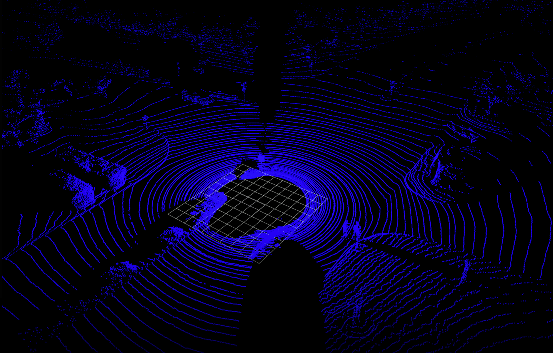
LiDAR sensor output. The blue indicates the detected, close-together points and the grid in the center is the space that the self-driving car occupies in the scene.
Point Clouds
Since LiDAR uses laser light, which sends out a thin light beam, the data it collects ends up being many single points also called point clouds. These point clouds can tell us a lot about an object like its shape and surface texture. By clustering points and analyzing them, this data provides enough information to classify an object or track a cluster of points over time!
Below, you can see the result of a classification algorithm performed on these points. The red are pedestrians and green indicates other cars.
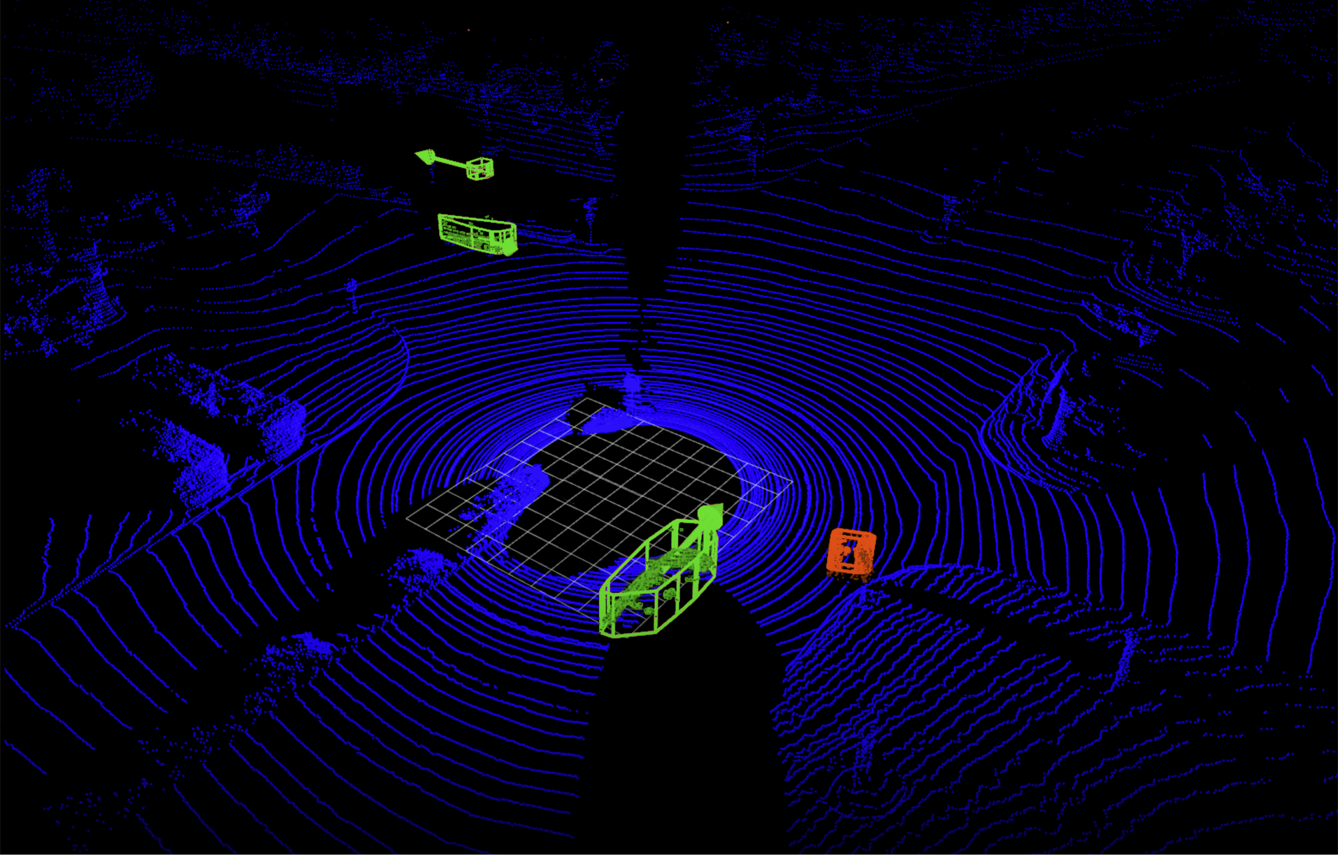
That same LiDAR data, sent through a classifier that clusters the points together and classifies them as a human (red) or as a car wth some velocity (green).
Visual World
As you can see, LiDAR data provides enough spatial information to create a visual world representation, and in industry, computer vision techniques can be used to classify objects using not only camera images, but also point clouds and other types of spatially coherent data!